In GEOG 489, you will learn advanced applications of Python for developing …
In GEOG 489, you will learn advanced applications of Python for developing and customizing GIS software, designing user interfaces, solving complex geoprocessing tasks, and leveraging open source. The course consists of readings, walkthroughs, projects, quizzes, and discussions about advanced GIS programming concepts and techniques, and a final term project. It complements the material covered in GEOG 485: GIS Programming and Customization. Software covered in the course includes: Esri ArcGIS Pro/arcpy, Jupyter Notebook, Esri ArcGIS API for Python, QGIS, GDAL/OGR. Students will also use of the Git version control software for code management, and learn techniques for distributing Python applications to end users.
This first year Geography textbook takes a holistic approach to Geography by …
This first year Geography textbook takes a holistic approach to Geography by incorporating elements of physical, human and regional geography, as well as bringing in methods and perspectives from spatial information science.. This textbook applies a fundamental geographical approach to understanding our globally changing world by looking at local processes which are linked to larger global processes and events. For example mining and its effects are a global issue and we can see how these unfold in BC. A further example is the recent apology to First Nation peoples on the residential school treatment, as similar events occur in the US, Ireland and Australia. Processes of urbanization, a phenomenon which people all over the globe are experiencing, can be seen in Vancouver with our discussion of the citys development. Geography students, indeed all first year students, need to be able to critically assess their own contexts and environments in order to properly engage with our continually globalizing world.
Maps are powerful visual tools, both for communicating ideas and for facilitating …
Maps are powerful visual tools, both for communicating ideas and for facilitating data exploration. In Geog 486: Cartography and Visualization, you will learn design principles and techniques for creating maps with contemporary mapping tools, including ArcGIS Pro. In this lab-focused course, you'll apply cartographic theory to practical problems, with a focus on design decisions such as selecting visual variables, classifying and generalizing data, applying principles of color and contrast, and choosing projections for maps. You will also be introduced to future-focused application topics such as augmented and virtual reality, mapping with multivariate glyphs, the visual depiction of uncertainty, interactive geovisualizations and (geo)visual analytics, and decision-making with maps and mapping products. Successful completion of this course will signify mastery in map production for communication and research; you will be practiced in making, analyzing, critiquing, and sharing high-quality maps.
Is your understanding of Cloud GIS a bit hazy? Does thinking about …
Is your understanding of Cloud GIS a bit hazy? Does thinking about it leave you in a fog? We've designed GEOG 865, Cloud and Server GIS, to help you understand how all of the various pieces of architecture fit together. By the end of the class you'll have a clear understanding of esri's and others' offerings in the space, how to implement ArcGIS Enterprise on Amazon EC2, make online maps with Carto and Mapbox, and engage in some blue sky thinking of your own in our weekly discussions about trends and directions.
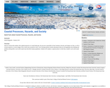
Has your attention recently been caught by news of coastal catastrophes such …
Has your attention recently been caught by news of coastal catastrophes such as hurricanes and tsunamis? Do you wonder why so many coastal communities in the world are vulnerable to flooding and other coastal hazards? Have you considered what coastal flood protections cities like Houston and Miami will need in the future to protect their residents? This course will provide a better understanding of these phenomena. We present a global perspective of coastal landscapes, the geologic processes responsible for their formation, and ways that society responds to hazards like sea level rise and catastrophic weather events. You will participate in active learning exercises such as analyzing real-world datasets and applying critical thinking to real-world societal problems while investigating a coastal community.
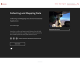
Learn how to collect and import spatial features from the field, use …
Learn how to collect and import spatial features from the field, use web-based map tools to engage citizens, and incorporate the best available spatial data from public domain sources.
This e-book provides interactive lessons and hands-on exercises for anyone interested in applying GIS and related tools to conservation and environmental applications. The lessons in this book assume users have a basic proficiency in GIS. Through these lessons and exercises, you will explore and use applications of GIS particularly related to landscape assessment, suitability modeling, and design of alternative strategies. By engaging with the activities in this book, you will:
Know how to collect and work with spatial data from the field and public domain; -Learn to frame and practice solving spatial environmental questions; -Proficiently apply spatial thinking and analytical tools toward conservation and adaptation solutions -Confidently apply spatial analyst and spatial statistics tools to compare and evaluate landscape change -Model and synthesize potential environmental scenarios -Design and plan strategies for adaptation to landscape change
Increasingly volatile climate and weather; vulnerable drinking water supplies; shrinking wildlife habitats; …
Increasingly volatile climate and weather; vulnerable drinking water supplies; shrinking wildlife habitats; widespread deforestation due to energy and food production. These are examples of environmental challenges that are of critical importance in our world, both in far away places and close to home, and are particularly well suited to inquiry using geographic information systems. In GEOG 487 you will explore topics like these and learn about data and spatial analysis techniques commonly employed in environmental applications. After taking this course you will be equipped with relevant analytical approaches and tools that you can readily apply to your own environmental contexts.
Essentials of Geographic Information Systems integrates key concepts behind the technology with …
Essentials of Geographic Information Systems integrates key concepts behind the technology with practical concerns and real-world applications. Recognizing that many potential GIS users are nonspecialists or may only need a few maps, this book is designed to be accessible, pragmatic, and concise. Essentials of Geographic Information Systems also illustrates how GIS is used to ask questions, inform choices, and guide policy. From the melting of the polar ice caps to privacy issues associated with mapping, this book provides a gentle, yet substantive, introduction to the use and application of digital maps, mapping, and GIS.
Estuarine Geography utilizes an ecological approach to understanding physical and biological parameters …
Estuarine Geography utilizes an ecological approach to understanding physical and biological parameters to estuarine evolution.. Superimposed upon that spatial site and situation are social, human, cultural and political activities. Humans role in estuarine evolution is discussed at length.
ìExploring Imagery and Elevation Data in GIS Applicationsî (GEOG 480) focuses on …
ìExploring Imagery and Elevation Data in GIS Applicationsî (GEOG 480) focuses on the use of remotely sensed imagery and elevation data in GIS applications. Students enrolling in GEOG 480 should have a solid conceptual foundation in geospatial information science and technology. GEOG 480 is appropriate for those who are already working in the geospatial profession and wish to use imagery and elevation data in visualization and spatial analysis. Throughout the course, students confront realistic remote sensing problem scenarios that incorporate such skills and concepts as definition of data needs, metadata content standards, data formats and types, and analysis methods.
PhysicalGeography.net is an educational web portal that focuses on a specific area …
PhysicalGeography.net is an educational web portal that focuses on a specific area knowledge known as Physical Geography. Physical Geography is a sub-discipline of two much larger fields of study - Geography and Earth Sciences.
This is an Introduction to Geography course (GEOG 2010) that was transformed …
This is an Introduction to Geography course (GEOG 2010) that was transformed to utilize OER. The package provided here contains all of the quizzes and exams that the course uses in the corresponding OER online textbooks. Direct links to each chapter can be found in the course syllabus. Quizzes and syllabus licensed CC BY 4.0 by Rusti Liner, adapting content from "Introduction to Physical Geography" and "Introduction to Human Geography", by R. Adam Dastrup is licensed under CC BY 4.0
This is an Introduction to Geographic Information Systems (GIS) course (GEOG 2037) …
This is an Introduction to Geographic Information Systems (GIS) course (GEOG 2037) that was completely copied and borrowed for a face to face delivery and also online delivery. I have modified the modules to work for a 16-week semester format. Additional updates will be provided as they become available. The entire course utilizes QGIS, a free shareware GIS package that is open source.
This is a Physical Geography course (GEOG 2050) that was transformed to …
This is a Physical Geography course (GEOG 2050) that was transformed to utilize OER. The package provided here contains all of the quizzes and exams that the course uses in the corresponding OER online textbooks. Direct links to each chapter can be found in the course syllabus. Quizzes and syllabus licensed CC BY 4.0 by Rusti Liner, adapting content from "Introduction to Physical Geography" by R. Adam Dastrup is licensed under CC BY 4.0
In GEOG 489, you will learn advanced applications of Python for developing …
In GEOG 489, you will learn advanced applications of Python for developing and customizing GIS software, designing user interfaces, solving complex geoprocessing tasks, and leveraging open source. The course consists of readings, walkthroughs, projects, quizzes, and discussions about advanced GIS programming concepts and techniques, and a final term project. It complements the material covered in GEOG 485: GIS Programming and Customization. Software covered in the course includes: Esri ArcGIS Pro/arcpy, Jupyter Notebook, Esri ArcGIS API for Python, QGIS, GDAL/OGR. Students will also use of the Git version control software for code management, and learn techniques for distributing Python applications to end users.
This is not a typical e-book; it is a free, web-based, open-source …
This is not a typical e-book; it is a free, web-based, open-source “textbook” available to anyone interested in using mapping tools to create maps. This e-text focuses primarily on Geographic Information Systems (GIS)—a geospatial technology that enables you to create spatial databases, analyze spatial patterns, and produce maps that communicate more effectively. While this GIS textbook is principally an introduction to GIS, most of the chapter’s concepts are applicable to other geotechnologies including remote sensing, global positioning systems (GPS), Internet mapping, and virtual globes.
Creating good maps and analyzing spatial data is a time consuming and challenging practice, but recently, a new set of powerful mapping tools has enabled almost anyone with a computer to make maps easily and to perform at least some low-level analyses. The results, however, are not encouraging. Most of the new mapmakers do not have adequate training in mapping concepts and spatial analysis principles, and their maps are often improperly designed and do not communicate easily nor effectively. This e-text—GIS Commons—seeks to help you analyze spatial data and communicate more effectively. In short, GIS education is our goal.
A good detective or researcher like Sherlock Holmes knows the fundamental questions …
A good detective or researcher like Sherlock Holmes knows the fundamental questions that need to be answered to gather facts to solve a problem. So how does geospatial intelligence contribute to answering these questions? While geospatial technology is useful in revealing who, what, when, and where events take place, it is less useful in explaining why events occur. However, geospatial intelligence analysis leverages geographic information science and technology with the intelligence tradecraft to develop products that support decision-making in national and homeland security, law enforcement, emergency management, and international relief efforts. GEOG 882 will challenge you to think critically, consider alternative viewpoints, and question your own assumptions when analyzing why human events occur over place and time.
In this data rich world, we need to understand how things are …
In this data rich world, we need to understand how things are organized on the Earth's surface. Those things are represented by spatial data and necessarily depend upon what surrounds them. Spatial statistics provide insights into explaining processes that create patterns in spatial data. In geographical information analysis, spatial statistics such as point pattern analysis, spatial autocorrelation, and spatial interpolation will analyze the spatial patterns, spatial processes, and spatial association that characterize spatial data. Understanding spatial analysis will help you realize what makes spatial data special and why spatial analysis reveals a truth about spatial data.
No restrictions on your remixing, redistributing, or making derivative works. Give credit to the author, as required.
Your remixing, redistributing, or making derivatives works comes with some restrictions, including how it is shared.
Your redistributing comes with some restrictions. Do not remix or make derivative works.
Most restrictive license type. Prohibits most uses, sharing, and any changes.
Copyrighted materials, available under Fair Use and the TEACH Act for US-based educators, or other custom arrangements. Go to the resource provider to see their individual restrictions.