In GEOG 489, you will learn advanced applications of Python for developing …
In GEOG 489, you will learn advanced applications of Python for developing and customizing GIS software, designing user interfaces, solving complex geoprocessing tasks, and leveraging open source. The course consists of readings, walkthroughs, projects, quizzes, and discussions about advanced GIS programming concepts and techniques, and a final term project. It complements the material covered in GEOG 485: GIS Programming and Customization. Software covered in the course includes: Esri ArcGIS Pro/arcpy, Jupyter Notebook, Esri ArcGIS API for Python, QGIS, GDAL/OGR. Students will also use of the Git version control software for code management, and learn techniques for distributing Python applications to end users.
Maps are powerful visual tools, both for communicating ideas and for facilitating …
Maps are powerful visual tools, both for communicating ideas and for facilitating data exploration. In Geog 486: Cartography and Visualization, you will learn design principles and techniques for creating maps with contemporary mapping tools, including ArcGIS Pro. In this lab-focused course, you'll apply cartographic theory to practical problems, with a focus on design decisions such as selecting visual variables, classifying and generalizing data, applying principles of color and contrast, and choosing projections for maps. You will also be introduced to future-focused application topics such as augmented and virtual reality, mapping with multivariate glyphs, the visual depiction of uncertainty, interactive geovisualizations and (geo)visual analytics, and decision-making with maps and mapping products. Successful completion of this course will signify mastery in map production for communication and research; you will be practiced in making, analyzing, critiquing, and sharing high-quality maps.
This textbook is intended to provide the core elements of a curriculum …
This textbook is intended to provide the core elements of a curriculum for teaching environmental science at the introductory level in Canadian colleges and universities. This book is suitable for students beginning a program in environmental science, environmental studies, or sustainability. It is also appropriate for arts students who require a science elective, and for science students who require a non-major elective. This book was written from the ground-up to provide Canadian information and examples. This national context is integrated throughout the text, along with North American and global data that provide a broader perspective.
Other file formats here: https://open.bccampus.ca/browse-our-collection/find-open-textbooks/?uuid=1ff23e21-e22d-482d-9fc5-6ec698b6817e&contributor=&keyword=&subject=
Welcome to Environmental Sustainability in Practice! We are excited that you are …
Welcome to Environmental Sustainability in Practice! We are excited that you are interested in learning more about what is happening in the field of environmental sustainability. We have chosen to introduce you to five areas in which society is working towards environmental sustainability:
Introduction: What is Environmental Sustainability? Sustainability Education Environmental Planning and Management Sustainable Agriculture Geospatial Technologies and Environmental Sustainability Environmental Communications
What factors lead to a natural disaster? What causes a famine? Why …
What factors lead to a natural disaster? What causes a famine? Why do cities flood? According to a recent article in The Atlantic, Houston's flooding during the 2017 Hurricane Harvey was primarily caused by impervious pavement which prevents the absorption of water into the land. This example illustrates how nature and society are interlinked, which is the main focus of Geography 30, Penn State's introductory course to nature-society geography. In addition to examining the linkages between human development and natural hazards, this course will also explore human society's connection to food systems, climate change, urbanization and biodiversity. The course will also cover topics of ethics and decision making in order to help students evaluate the tradeoffs of these interconnections.
Topics of Study in this Course Unit 1 - Key Concepts Module 1 - Geographic Perspectives Module 2 - Coupled Human-Environment Systems Module 3 - Environmental Ethics Module 4 - Individual and Collective Action
Unit 2 - Sustainable Development Module 5 - Development Module 6 - Food and Agriculture Module 7 - Cities and Transportation
Unit 3 - Global Environmental Change Module 8 - Natural Hazards Module 9 - Climate Change Module 10 - Biodiversity
Description: Government, corporate, and public perspectives on the analysis, formulation, implementation, and …
Description: Government, corporate, and public perspectives on the analysis, formulation, implementation, and impacts of energy-related policies, regulations, and initiatives with particular emphasis on climate change implications.
By the end of our semester, you will have cultivated an in-depth understanding of the policy mechanisms employed to address energy challenges at a variety of geographic scales and you will have developed a polished research project on a topic of your choosing.
Course goals: Identify energy policy knowledge gaps and needs at various governmental and entity levels; Examine existing or proposed energy policy critically; expose errors, find unintended consequences of implementation, offer suggestions for improvement; Identify the drivers of energy policy from political, environmental, and economic perspectives; and explain how these drivers can exist either in conflict or complement of each other; Articulate the goals and outcomes of energy policy to diverse audiences, translating often-cumbersome legislative language into a more accessible format for stakeholders and the public.
Lesson 1: The Climate Connection - Linking Climate Policy to Energy Policy Lesson 2: What is policy and what kinds of policy are there? Lesson 3: Energy Policy - Past, Present, and Future Lesson 4: International Climate Action - Where do we go from here (and where is here)? Lesson 5: Local Scale Emissions and Mitigation Lesson 6: Citizens and Climate Lesson 7: Drivers of Policy Development Lesson 8: Assumptions in Policy Formulation
GEOG 485 is a required course in Penn State's Postbaccalaureate Certificate in …
GEOG 485 is a required course in Penn State's Postbaccalaureate Certificate in Geospatial Programming and Web Map Development and one of several electives students may choose as their final course leading to Penn State's Postbaccalaureate Certificate in Geographic Information Systems. It can also be applied toward the Penn State Geospatial Intelligence Graduate Certificate and Master of Geographic Information Systems degree.
The course focuses on solving geographic problems by modifying and automating generic Geographic Information System (GIS) software through programming. In GEOG 485, students use the Python programming language to write and modify scripts that add functionality to desktop GIS tools and to automate geospatial analysis processes. No previous programming experience is assumed. Core topics covered in this class include object-oriented programming, component object model technologies, object model diagrams, loops, if-then constructs, and modular code design, and situates these topics in the geospatial workflow through their integration with maps, layers, spatial data tables, and spatial analysis methods.
Lessons Lesson 1: Introduction to GIS modeling and Python Lesson 2: Python and programming basics Lesson 3: GIS data access and manipulation with Python Final Project proposal assignment Lesson 4: Practical Python for the GIS analyst
Geography 430 is an active, creative learning community focused around understanding the …
Geography 430 is an active, creative learning community focused around understanding the changing relationships between people and their environments, the causes and consequences of environmental degradation, strategies for building a more sustainable world, and the methods and approaches that scholars have used to understand human-environment interactions. The primary course objectives are to help geographers, earth scientists, and other professionals to deepen their appreciation for the complexity of human-environment systems and to develop skills that allow them to interpret, analyze, and communicate effectively regarding human-environment interactions in their lives as students, professionals, and citizens.
Lesson 0 - Orientation and Syllabus Lesson 1 - Global Environmental Change and Planetary Boundaries Lesson 2 - Complex Social-Ecological Systems Lesson 3 - Governance Lesson 4 - Environmental Justice Lesson 5 - The Food-Energy-Water Nexus Lesson 6 - Food Lesson 7 - Energy Lesson 8 - Water Lesson 9 - Biodiversity Conservation Lesson 10 - Land Use Change Lesson 11 - Climate Change
This book describes how Earth's climate is changing, how it has been …
This book describes how Earth's climate is changing, how it has been changing in the recent geological past and how it may change in the future. It covers the physical sciences that build the foundations of our current understanding of global climate change such as radiation, Earth's energy balance, the greenhouse effect and the carbon cycle. Both natural and human causes for climate change are discussed. Impacts of climate change on natural and human systems are summarized. Ethical and economical aspects of human-caused climate change and solutions are presented.
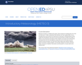
Benjamin Franklin is credited with saying, "Some people are weatherwise, but most …
Benjamin Franklin is credited with saying, "Some people are weatherwise, but most are otherwise." Ol' Ben understood that weather can have a great effect on our everyday lives, and he knew the importance of having an understanding of what makes the atmosphere work (and not just knowing when it's safe to fly a kite). In Meteo 3, we will examine all aspects of the weather. You'll learn the fundamental processes that drive the atmosphere, along with some of the tools we use to measure those processes. You'll also learn about large-scale weather systems, severe convection, tropical weather, and climate change. As a result, you'll be a better consumer of weather information and forecasts. So... do you want to be weatherwise?
Lesson 1: A Meteorologist's Toolbox Lesson 2: The Global Ledger of Heat Energy Lesson 3: Global and Local Controllers of Temperature Lesson 4: The Role of Water in Weather Lesson 5: Remote Sensing of the Atmosphere Lesson 6: Surface Patterns of Pressure and Wind Lesson 7: Mid-Latitude Weather Systems Lesson 8: The Role of Stability in Thunderstorm Formation Lesson 9: Severe Weather Lesson 10: The Human Impact on Weather and Climate Lesson 11: Patterns of Wind, Water, and Weather in the Tropics Lesson 12: Hurricanes Lesson 13: Becoming a Savvy Weather Consumer
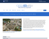
Do you enjoy the competitive challenge of starting up a new business …
Do you enjoy the competitive challenge of starting up a new business or expanding into new areas? Are you involved in economic and community development? Are you considering the best place to work and live? Do you like to gain an advantage? Location Intelligence for Business extends the application of geospatial intelligence analytical methods to the business world for competitive advantage. You will have an opportunity to understand and apply location technologies, geospatial analysis, and business geography (demographics and psychographics) to support competitive business decision-making. You will uncover and explore the key geospatial principles involved in site selection, market analysis, risk and crisis management, logistics, and transportation by solving those problems with available geospatial tools and data.
Lesson 1: Introduction to Location Intelligence Lesson 2: Business Modeling and Market Segmentation Lesson 3: GIS and Geospatial Analytical Modeling Lesson 4: Competitive Factors in Business Lesson 5: Risk Assessment Factors Lesson 6: Risk Assessment Case Study: Location Intelligence to Support AML/CTF Investigations Lesson 7: Sector Applications of Location Intelligence, Part 1 Lesson 8: Sector Applications of Location Intelligence, Part 2 Lesson 9: Emerging Trends and Technologies Lesson 10: Term Project
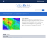
The Nature of Geographic Information is an orientation to the properties of …
The Nature of Geographic Information is an orientation to the properties of geographic data and the practice of distance learning. The purpose of this course is to promote an understanding of the Geographic Information Science and Technology (GIS&T) enterprise. GIS&T is the intersection of professions, institutions, and technologies that produce geographic data and render information from it. It is a rapidly growing and evolving field. Learning is a way of life for all GIS&T professionals. With this in mind, I hope that this text may contribute to your lifelong exploration of how geospatial technologies can be used to improve the quality of life-yours and your neighbors', locally and globally, now and in the future.
Chapters Chapter 1: Data and Information Chapter 2: Scales and Transformations Chapter 3: Census Data and Thematic Maps Chapter 4: TIGER, Topology and Geocoding Chapter 5: Land Surveying and GPS Chapter 6: National Spatial Data Infrastructure I Chapter 7: National Spatial Data Infrastructure II Chapter 8: Remotely Sensed Image Data Chapter 9: Integrating Geographic Data
Also available here: https://open.umn.edu/opentextbooks/textbooks/nature-of-geographic-information-systems
This course on petroleum refining reviews how a refinery integrates different physical …
This course on petroleum refining reviews how a refinery integrates different physical processes and chemical reactions to process crude oil for the production of transportation fuels and materials according to commercial specifications and environmental regulations. Classification of crude oils using standard analytical protocols helps the refiners select the optimum conditions for the most efficient and most profitable production of fuels and materials. Understanding the basic concepts and technical objectives for each process unit provides the knowledge base necessary to convert crude oil into desired products at minimum cost and low environmental impact. A discussion of how the refinery evolved from the days of one-pot distillation into the current complex configurations will inform an outlook from present to future.
Lesson 1: Introduction to Petroleum Refining and Crude Oil Composition Lesson 2: Properties and Classification of Crude Oil Lesson 3: Overall Refinery Flow Lesson 4: Separation Processes 1 Lesson 5: Separation Processes 2 Lesson 6: Thermal Conversion Processes Lesson 7: Catalytic Conversion Processes Part 1 Lesson 8: Catalytic Conversion Processes Part 2 Lesson 9: Finishing Processes Lesson 10: Supporting Processes Lesson 11: Past and Future of Petroleum Refining Lesson 12: Natural Gas Processing
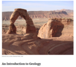
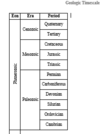
This is a review of "An Introduction to Geology", a free textbook …
This is a review of "An Introduction to Geology", a free textbook for college-level introductory geology courses, by Dr. Achim Herrmann (Department of Geology and Geophysics, LSU).The textbook is here: https://louis.oercommons.org/courses/an-introduction-to-geology-free-textbook-for-college-level-introductory-geology-courses
This is a review of an assignment that can be used in …
This is a review of an assignment that can be used in a variety of introductory geology classes to introduce students to the geologcial time scale. This review is by Dr. Achim Herrmann (Department of Geology and Geophysics, LSU).The resource is here: https://louis.oercommons.org/courses/starting-out-with-earth-history
Do you know how important GIS is to the transportation industry? The …
Do you know how important GIS is to the transportation industry? The spatial applications to this field are so extensive that they represent an entire sub-discipline within the GIS community. In this course, we'll learn about the primary modes of transportation and explore some of the spatial applications developed to meet the unique needs of each. We'll also take a close look at some key organizations in the industry and learn firsthand from more than a dozen transportation professionals about the role GIS plays for them. Throughout the course, we'll study GIS concepts and techniques that are fundamental to transportation and get hands-on experience with tools such as Esri's Network Analyst and Esri's Roads and Highways.
Lessons Lesson 1: Introduction to GIS-T Lesson 2: Roadway Centerline Data Lesson 3: Geocoding and Conflation Lesson 4: Transportation Networks Lesson 5: Network Analysis Lesson 6: Linear Referencing Systems (LRS) Lesson 7: Highway Safety Lesson 8: Traffic Lesson 9: Transit Lesson 10: Other Modes
Geospatial perspectives and technologies play a major role in planning for and …
Geospatial perspectives and technologies play a major role in planning for and responding to emergencies. Geospatial tools - from aerial mapping techniques to data acquisition, are changing rapidly as is emergency management as the frequency and magnitude of crises and disasters are increasing. This course provides an understanding of how geospatial perspectives and technologies support all stages of emergency management activities, from small scale emergency management efforts to large scale disaster/humanitarian efforts. This includes learning about commonly used and emerging geospatial tools. It also includes an exploration of advancements in data collection, processing and analysis capabilities, such as unmanned aerial systems, geospatial artificial intelligence, volunteered geographic information, social media, and many more.
Lessons Lesson 1: Spatial Data Science for Emergency Management Lesson 2: Hazards and Disasters Lesson 3: Vulnerability Assessment and Hazard Mitigation Lesson 4: Preparedness Lesson 5: Response Lesson 6: Recovery Lesson 7: Using Scenarios to Plan GIS for Emergency Management Lesson 8: Case Study Collaboration Lesson 9: Case Study – 2018 Sulawesi Earthquake and Tsunami Lesson 10: Term Project
Locating restaurants in an unfamiliar place, reporting potholes to the local DOT, …
Locating restaurants in an unfamiliar place, reporting potholes to the local DOT, obtaining real-time traffic conditions... All of these are examples of geospatial web apps that are revolutionizing how people obtain and share information about the world. In GEOG 863, you will learn how to build apps like these. You'll start with a quick look at the fundamentals of web programming (HTML and CSS) before diving in to using JavaScript and a mapping application programming interface (API) developed by Esri. Using this API, you'll create both 2D and 3D visualizations of your own data and learn how to develop a user interface to enable users to interact with your map.
Lessons
Lesson 1: Creating Mapping Apps Without Programming Lesson 2: Web Publishing Technologies: HTML/XHTML/CSS Lesson 3: Introduction to the ArcGIS API for JavaScript Lesson 4: Adding Layers Lesson 5: Layer Visualization Lesson 6: Adding Search & Query Capability Lesson 7: GUI Development Lesson 8: Geoprocessing Final Project Google Maps Content e-Portfolios Video Recording with Screencast-O-Matic
No restrictions on your remixing, redistributing, or making derivative works. Give credit to the author, as required.
Your remixing, redistributing, or making derivatives works comes with some restrictions, including how it is shared.
Your redistributing comes with some restrictions. Do not remix or make derivative works.
Most restrictive license type. Prohibits most uses, sharing, and any changes.
Copyrighted materials, available under Fair Use and the TEACH Act for US-based educators, or other custom arrangements. Go to the resource provider to see their individual restrictions.