This course relies on primary readings from the database community to introduce …
This course relies on primary readings from the database community to introduce graduate students to the foundations of database systems, focusing on basics such as the relational algebra and data model, schema normalization, query optimization, and transactions. It is designed for students who have taken 6.033 (or equivalent); no prior database experience is assumed, though students who have taken an undergraduate course in databases are encouraged to attend.
The course covers the basic models and solution techniques for problems of …
The course covers the basic models and solution techniques for problems of sequential decision making under uncertainty (stochastic control). We will consider optimal control of a dynamical system over both a finite and an infinite number of stages. This includes systems with finite or infinite state spaces, as well as perfectly or imperfectly observed systems. We will also discuss approximation methods for problems involving large state spaces. Applications of dynamic programming in a variety of fields will be covered in recitations.
Increasingly volatile climate and weather; vulnerable drinking water supplies; shrinking wildlife habitats; …
Increasingly volatile climate and weather; vulnerable drinking water supplies; shrinking wildlife habitats; widespread deforestation due to energy and food production. These are examples of environmental challenges that are of critical importance in our world, both in far away places and close to home, and are particularly well suited to inquiry using geographic information systems. In GEOG 487 you will explore topics like these and learn about data and spatial analysis techniques commonly employed in environmental applications. After taking this course you will be equipped with relevant analytical approaches and tools that you can readily apply to your own environmental contexts.
This is a collection of all materials used in Health Information Technology …
This is a collection of all materials used in Health Information Technology by Dr. Chi Zhang at Kennesaw State University, including lecture slides, assignments, and assessments, including a question bank.
Topics covered include:
Clinical Financial Records Evidence-Based Medicine e-Prescribing Patient Bedside Systems Telemedicine Health Information Networks Cryptography Accreditation HIPAA Privacy and Security
This is a course on the fundamentals of probability geared towards first- …
This is a course on the fundamentals of probability geared towards first- or second-year graduate students who are interested in a rigorous development of the subject. The course covers most of the topics in 6.431 (sample space, random variables, expectations, transforms, Bernoulli and Poisson processes, finite Markov chains, limit theorems) but at a faster pace and in more depth. There are also a number of additional topics, such as language, terminology, and key results from measure theory; interchange of limits and expectations; multivariate Gaussian distributions; deeper understanding of conditional distributions and expectations.
Geography 468 provides the geospatial information system professional an overview of systems …
Geography 468 provides the geospatial information system professional an overview of systems analysis and design with emphasis on the concepts behind the process, including: business use case modeling, business object modeling, requirements definition, analysis and preliminary design, and, finally, detailed design. The concepts of the geospatial software and database development process are introduced and the current modeling techniques are addressed within the geospatial systems development paradigm. In a series of related activities, students learn about the methods, tools and the concepts of the systems development process to document a portion of a geospatial system with Unified Modeling Language (UML), the standard graphical notation for modeling application needs.
Bill Gates is credited with saying he would \hire a lazy person …
Bill Gates is credited with saying he would \hire a lazy person to do a difficult job\" with the justification that \"a lazy person will find an easy way to do it.\" GEOG 485 doesn't teach the lazy way to get the job done, but it does teach the scripting way _ which is arguably even better. You've probably heard the \"give a fish\"/\"teach to fish\" saying? That's the gist of GEOG 485: to equip you, in an ArcGIS context, with the ModelBuilder and Python scripting skills to make your boring, repetitive geoprocessing tasks easier, quicker and automatic _ so you can focus on the more interesting (potentially more valuable) work that you (and your employers) really want you to be doing."
Today GPS is critical to positioning, navigation, and timing. The smooth functioning …
Today GPS is critical to positioning, navigation, and timing. The smooth functioning of financial transactions, air traffic, ATMs, cell phones and modern life in general around the world depend on GPS. This very criticality requires continuous modernization. The oldest satellites in the current constellation were launched in the 1990s. If you imagine using a computer of that vintage today, it is not surprising that the system is being substantially updated. Global Positioning System (GPS) is now a part of a growing international con?text-the Global Navigation Satellite System, GNSS. This course dives into how GPS and other GNSS systems are designed, how they operate, and the impacts they have on spatial analysis and spatially-enabled systems.
This course will provide a gentle, yet intense, introduction to programming using …
This course will provide a gentle, yet intense, introduction to programming using Python for highly motivated students with little or no prior experience in programming. The course will focus on planning and organizing programs, as well as the grammar of the Python programming language. The course is designed to help prepare students for 6.01 Introduction to EECS. 6.01 assumes some knowledge of Python upon entering; the course material for 6.189 has been specially designed to make sure that concepts important to 6.01 are covered. This course is offered during the Independent Activities Period (IAP), which is a special 4-week term at MIT that runs from the first week of January until the end of the month.
A good detective or researcher like Sherlock Holmes knows the fundamental questions …
A good detective or researcher like Sherlock Holmes knows the fundamental questions that need to be answered to gather facts to solve a problem. So how does geospatial intelligence contribute to answering these questions? While geospatial technology is useful in revealing who, what, when, and where events take place, it is less useful in explaining why events occur. However, geospatial intelligence analysis leverages geographic information science and technology with the intelligence tradecraft to develop products that support decision-making in national and homeland security, law enforcement, emergency management, and international relief efforts. GEOG 882 will challenge you to think critically, consider alternative viewpoints, and question your own assumptions when analyzing why human events occur over place and time.
In this data rich world, we need to understand how things are …
In this data rich world, we need to understand how things are organized on the Earth's surface. Those things are represented by spatial data and necessarily depend upon what surrounds them. Spatial statistics provide insights into explaining processes that create patterns in spatial data. In geographical information analysis, spatial statistics such as point pattern analysis, spatial autocorrelation, and spatial interpolation will analyze the spatial patterns, spatial processes, and spatial association that characterize spatial data. Understanding spatial analysis will help you realize what makes spatial data special and why spatial analysis reveals a truth about spatial data.
Geographic Intelligence (GEOINT) is more than people working with computers in a …
Geographic Intelligence (GEOINT) is more than people working with computers in a secure intelligence facility. Join us for this exciting journey to learn about GEOINT's application in business, law enforcement, and defense. Advances in satellites, GPS, unmanned aerial systems, wireless communications, handheld computing, and the ability to automate laborious map analysis processes has transformed what used to be called geographic intelligence, or GEOINT, and the nature of the insights provided to managers and leaders. We have gone from mountains of hardcopy maps to amazing automated systems that provide previously unavailable understanding. GEOINT combines geographic information science and technologies with an analytic tradecraft. You will experience the value of GEOINT. We welcome you to the Revolution.
This course is a collaborative offering of Sana, Partners in Health, and …
This course is a collaborative offering of Sana, Partners in Health, and the Institute for Healthcare Improvement (IHI). The goal of this course is the development of innovations in information systems for developing countries that will (1) translate into improvement in health outcomes, (2) strengthen the existing organizational infrastructure, and (3) create a collaborative ecosystem to maximize the value of these innovations. The course will be taught by guest speakers who are internationally recognized experts in the field and who, with their operational experiences, will outline the challenges they faced and detail how these were addressed.This OCW site combines resources from the initial Spring 2011 offering of the course (numbered HST.184) and the Spring 2012 offering (numbered HST.S14).
The Histology Laboratory Drawings resource contains 104 hand drawn sketches by Dr. …
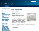
The Histology Laboratory Drawings resource contains 104 hand drawn sketches by Dr. Christensen for the laboratory sessions he conducted in the Medical Histology Course for first year medical students. The drawings were done with felt markers on a white board in the lab during the morning of the day a particular topic was being studied in the course. When the laboratory session began, the drawings were briefly discussed, and they could be seen by the students throughout the laboratory period.You can view the drawings individually on flickr, or you can download the full collection of drawings by navigating to the materials tab.
This freshman course explores the scientific publication cycle, primary vs. secondary sources, …
This freshman course explores the scientific publication cycle, primary vs. secondary sources, and online and in-print bibliographic databases; how to search, find, evaluate, and cite information; indexing and abstracting; using special resources (e.g. patents) and "grey literature" (e.g. technical reports and conference proceedings); conducting Web searches; and constructing literature reviews.
To be information literate, a person must be able to recognize when …
To be information literate, a person must be able to recognize when information is needed and have the ability to locate, evaluate, and use effectively the needed information. By the end of this unit you will be able to Define Information Literacy, Define the four domains that fall under Metaliterate Learners, Identify a lack of knowledge in a subject area, Identify a search topic/question and define it using simple terminology, Articulate current knowledge on a topic, Recognize a need for information and data to achieve a specific end and define limits to the information need, and Manage time effectively to complete a search.
During your studies you will frequently be asked to write a paper. …
During your studies you will frequently be asked to write a paper. For such a paper you will need information, but how do you get it? What exactly do you need? Where can you find it? How do you go about it? Almost anyone can use Google, of course, but more is expected of a TU Delft student! We challenge you to go beyond using the popular search engines. This instruction will help you discover what there is to learn about information skills.
This instruction follows on from the online instruction Information Literacy 1, in …
This instruction follows on from the online instruction Information Literacy 1, in which you learned how to find, evaluate and use information. Today’s instruction is intended for advanced users.
This collection brings together scholarship and pedagogy from multiple perspectives and disciplines, …
This collection brings together scholarship and pedagogy from multiple perspectives and disciplines, offering nuanced and complex perspectives on Information Literacy in the second decade of the 21st century. Taking as a starting point the concerns that prompted the Association of Research Libraries (ACRL) to review the Information Literacy Standards for Higher Education and develop the Framework for Information Literacy for Higher Education (2015), the chapters in this collection consider six frameworks that place students in the role of both consumer and producer of information within today's collaborative information environments. Contributors respond directly or indirectly to the work of the ACRL, providing a bridge between past/current knowledge and the future and advancing the notion that faculty, librarians, administrators, and external stakeholders share responsibility and accountability for the teaching, learning, and research of Information Literacy.
Good researchers have a host of tools at their disposal that make …
Good researchers have a host of tools at their disposal that make navigating today’s complex information ecosystem much more manageable. Gaining the knowledge, abilities, and self-reflection necessary to be a good researcher helps not only in academic settings, but is invaluable in any career, and throughout one’s life. The Information Literacy User’s Guide will start you on this route to success.The Information Literacy User’s Guide is based on two current models in information literacy: The 2011 version of The Seven Pillars Model, developed by the Society of College, National and University Libraries in the United Kingdom and the conception of information literacy as a metaliteracy, a model developed by one of this book’s authors in conjunction with Thomas Mackey, Dean of the Center for Distance Learning at SUNY Empire State College. These core foundations ensure that the material will be relevant to today’s students.The Information Literacy User’s Guide introduces students to critical concepts of information literacy as defined for the information-infused and technology-rich environment in which they find themselves. This book helps students examine their roles as information creators and sharers and enables them to more effectively deploy related skills. This textbook includes relatable case studies and scenarios, many hands-on exercises, and interactive quizzes.
No restrictions on your remixing, redistributing, or making derivative works. Give credit to the author, as required.
Your remixing, redistributing, or making derivatives works comes with some restrictions, including how it is shared.
Your redistributing comes with some restrictions. Do not remix or make derivative works.
Most restrictive license type. Prohibits most uses, sharing, and any changes.
Copyrighted materials, available under Fair Use and the TEACH Act for US-based educators, or other custom arrangements. Go to the resource provider to see their individual restrictions.